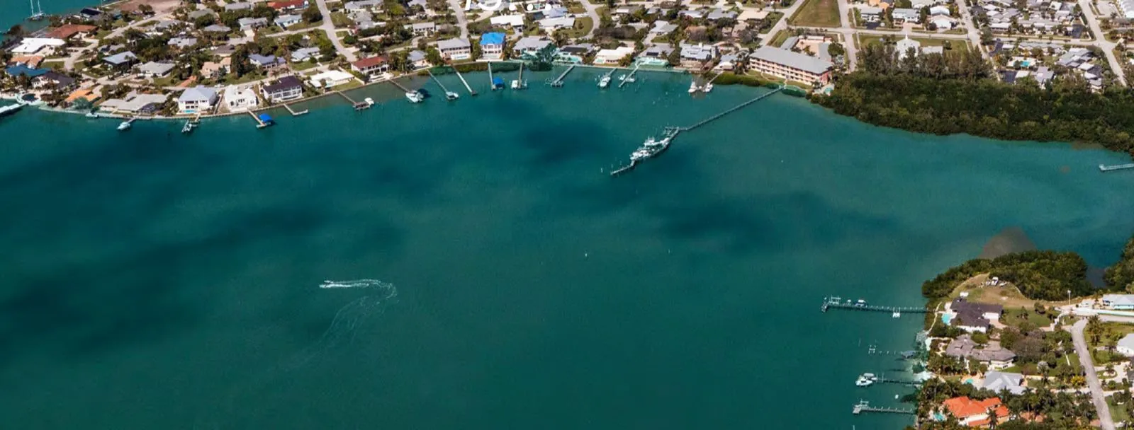
Cape Coral is known for its canals, and a canal lot is often the reason people choose the city. But “on the water” can mean very different things here. Some canals lead out to the Caloosahatchee River and the Gulf. Others are freshwater canals with no boat route to open water at all. This guide explains how the system works, what to check on a specific lot, and what to think about before you buy.
How Big Is Cape Coral’s Canal System?
The City of Cape Coral describes its canal network as more than 400 miles long. The City says many of those canals have direct access to the Caloosahatchee River and the Gulf.
The canals are not just scenery. According to the City, the system was designed to provide flood control and water quality benefits. Canals carry stormwater runoff away from homes and streets, which helps reduce flooding during heavy rain.
The City’s Marine Services Division, part of Parks and Recreation, oversees the waterways. Canal dredging is handled by the City and paid for through its Stormwater Fund, which is collected on annual property tax bills.
Saltwater Canals vs. Freshwater Canals
The biggest split in Cape Coral is between saltwater and freshwater canals. They look similar from the backyard, but they work very differently.
Saltwater canals
Saltwater canals connect, directly or through other canals, to tidal waters. The City’s own launch-site descriptions give a sense of how this works:
- Rosemary Canal (saltwater) connects with several canals and leads to Matlacha Pass.
- Chantrey Canal (saltwater) connects with the Caloosahatchee River.
- Saint Michael Canal connects to the North Spreader Waterway and Tortuga Canal (saltwater).
If you want to keep a boat at home and run it to the river or the Gulf, you are looking for a saltwater canal with a workable route out.
Freshwater canals
Freshwater canals are a separate system. The City says weirs and control structures in the freshwater canals help manage water levels and store excess stormwater. The freshwater canals also provide irrigation storage, and the City pumps canal water to supplement its irrigation system.
Freshwater canals can still be used for recreation. The City’s BMX boat ramp, for example, launches into Shelburne Canal, which connects with several freshwater canals and lakes. But a freshwater canal is not a route to the Gulf.
What “Gulf Access” Really Means
“Gulf access” is a real estate term, not a single official category. Two saltwater lots can both be called Gulf access and still offer very different boating.
Ask these questions about the route from the lot to open water:
- How far is it? Some lots sit close to the river. Others wind through many canals first.
- Are there bridges along the way? Road bridges cross many canals. The lowest bridge on your route sets a limit on how tall a boat can pass under it.
- How deep is the water? The City notes that canals lose depth over time to sedimentation and erosion, which is one reason it runs a dredging program to maintain navigability.
The only reliable way to answer these questions is to check the specific route. A local boat captain, a marine contractor or an experienced waterfront agent can help you understand it.
The Chiquita Lock: What Changed
For years, the Chiquita Lock was a factor for boaters on the city’s southwest side. According to the Cape Coral Breeze, the lock regulated water flow from the South Spreader and provided boat access in and out of the South Spreader Waterway. The City pursued its removal because of long-term maintenance and boating constriction issues.
The Sanibel-Captiva Conservation Foundation reports that the lock was built in the 1980s and damaged by Hurricane Ian in 2022. The City closed the lock to boat traffic on April 1, 2025, to remove it as part of its South Spreader Waterway Enhancement Project, and city leaders marked the removal in July 2025.
The removal was debated. The conservation foundation has raised concerns about water quality in surrounding waters and says it is monitoring local trends. If you are looking at property along the South Spreader, older listings or advice that mention “the lock” may be out of date. Check current conditions with the City.
Docks, Boat Lifts and Permits
A canal lot usually comes with plans for a dock, a boat lift or both. In Cape Coral, these are marine improvements that need permits.
The City’s residential boat lift guideline lists what an application includes. Highlights:
- A Marine Improvement application, plus a site plan showing the dock and lift location and setbacks.
- Engineering specifications for the lift.
- State DEP approval if the lift is not on fresh water.
- A separate electrical permit, issued before the lift inspection.
- A final signed and sealed survey before final inspection, as the City’s Land Development Code requires for docks, mooring piles and similar structures.
The same guideline carries a clear warning: a City permit is not by itself approval to start construction. The applicant must also obtain approval from state and federal agencies, such as the U.S. Army Corps of Engineers. Freshwater lots generally skip the state DEP step.
Canal lots also generally need a seawall (on freshwater canals, the City also allows certain engineered alternatives), and that has its own permit and design standards. If you are planning to build, our guide to building on a vacant lot in Cape Coral covers how the seawall fits into the overall sequence.
How to Check a Lot’s Canal Type and Access
Don’t rely on a listing description alone. Here is how to check for yourself.
Use the City’s GIS maps. The City’s GIS includes property parcels and canals, and its interactive maps are available to the public through the City website (CapeIMS). You can also download City data layers from its Open Data Portal.
Trace the route. On the map, follow the canal from the lot to the river or Matlacha Pass. Note every bridge and canal junction along the way.
Ask the City. The Marine Services Division oversees Cape Coral’s waterways and is a good place to ask about a specific canal. For permit questions, the City’s permitting staff can tell you what a dock, lift or seawall on that lot would require.
Look at the lot itself. Is there a seawall, and what condition is it in? Is there an existing dock or lift, and was it permitted? Ask the seller for permit records, or look up the address with the City’s online permit search.
Your Canal Lot Checklist
Before you make an offer on a canal lot, confirm:
- Saltwater or freshwater canal
- The full boat route to open water, including bridges
- Water depth along the route and at the lot
- Seawall condition, or the cost and timing to build one
- What a dock and boat lift would require (City, state and federal approvals)
- Past permits for existing marine structures
Rules and conditions change. Confirm details for a specific lot with the City of Cape Coral or a licensed professional.
What Canal Buyers Should Think About
Start with how you will actually use the water. If you want to fish from the backyard or paddle a kayak, a freshwater canal may suit you well. If you plan to keep a boat and head out to the river or the Gulf often, the route matters as much as the lot.
Think about the boat you have, or the one you plan to buy. Its height and draft should match the bridges and depth on your route.
Plan for the waterfront. The seawall, dock and lift each have their own permits and timelines. On a vacant lot, these can affect when you can start building and when you can move in.
Talk With Proudhouse Builders
Proudhouse Builders plans, designs and builds homes in Southwest Florida. Whether you are weighing a canal lot or looking for a home on the water, we can help you think through the questions above. Explore buying a home with us, call (239) 321-0594, or reach us through our contact page. You bring the land, we do the rest.
Sources
- City of Cape Coral, Boating (400+ miles of canals, many with direct access to the Caloosahatchee River and Gulf; Marine Services Division): capecoral.gov/department/parks_and_recreationhome/beaches.ph…
- City of Cape Coral, Canal Dredging Program (canal purposes, weirs and control structures, irrigation storage, Stormwater Fund, sedimentation and navigability): capecoral.gov/departments/public_works/public_works_operatio…
- City of Cape Coral, Water Reclamation (freshwater canal water pumped to supplement irrigation; weirs and pumping stations): capecoral.gov/department/utilities_department/utilities_wate…
- City of Cape Coral, Kayaking (Rosemary, Chantrey, Saint Michael and Shelburne canal descriptions): capecoral.gov/departments/parks_recreation/eco_tourism_recre…
- City of Cape Coral, Geographic Information System (GIS) (parcel and canal layers, CapeIMS, Open Data Portal): capecoral.gov/department/information_technology_services/gis…
- City of Cape Coral, Boatlift Only – Residential Permit Guidelines (Last Rev. 6/18/2020): capecoral.gov/Documents/Document%20Hub/Permit%20Document%20C…
- City of Cape Coral, Permit Document Center: capecoral.gov/departments/development_services/permitting_se…
- City of Cape Coral, Notice to Industry: Revision of Commercial and Residential Seawall Alternative Guidelines (effective Jan. 1, 2022; freshwater alternatives): capecoral.gov/Documents/Departments/Development%20Services/N…
- Fort Myers Beach Observer, “Cape explores seawall assessment” (June 13, 2019) (seawalls required, owner responsibility): fortmyersbeachtalk.com/news/swfl-news/2019/06/cape-explores-…
- Cape Coral Breeze, “Cape council awards $3.7 million contract for removal of Chiquita Lock” (Sept. 6, 2024): capecoralbreeze.com/news/local-news/2024/09/06/cape-council-…
- City of Cape Coral via CHNEP Water Atlas, “Chiquita Lock removal scheduled for April-June 2025” (Oct. 25, 2024): chnep.wateratlas.usf.edu/news/details/23415
- Sanibel-Captiva Conservation Foundation, “Chiquita Lock removed despite unknown water quality impacts” (July 28, 2025): sccf.org/2025/07/28/chiquita-lock-removed-despite-unknown-wa…
Own land in Southwest Florida?
Our team can tell you what your parcel can become. Call (239) 321-0594 or start a land review online.
Start a land review

